Project management tools like , Notion, Basecamp, Lark, Slack, Asana and Trello.
AI chatbot tools like ChatGPT, Grok, Perplexity, Claude, Gemini and Copilot.
Marketing analytics platforms like Google Analytics, Similarweb and Semrush.
CRM systems like HubSpot, Apollo.io Pipedrive, Zoho CRM, and Salesforce.
VPNs, SSO providers, and password managers like NordVPN, Okta, and LastPass.
Email marketing and campaign tools like MailerLite, Instantly, and Mailchimp.
Website builders, hosting tools like Hostinger, Webflow, Framer, and Shopify
HR and recruiting software like ATS platforms, BambooHR, Workday, and Lever.
Automate finances with confidence like Quickbooks, Stripe, Brex, and Mercury.
Design and editing tools like Figma, Canva, Adobe Creative Cloud, CapCut.
Workflow automation tools like Zapier, Make, Clay, and Reclaim.ai.
No-code and AI-native dev tools like Cursor, Windsurf, Lovable and Bubble.

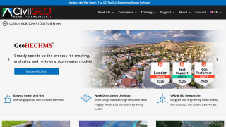
GeoHECRAS is advanced river modeling software, ideal for civil engineers, offering seamless 1D/2D HEC-RAS model creation, CAD/GIS integration, automated FEMA compliance, and LiDAR processing. Compared to alternatives like Civil 3D and MicroStation, it excels in user-friendliness and workflow automation but is pricier than free basic HEC-RAS. Its powerful visualization and model calibration features save engineers significant time. Backed by excellent customer support, it’s cost-effective for professionals requiring robust tools.
MicroStation, a robust CAD tool for architects, engineers, and construction professionals, excels in 2D/3D modeling, parametric design, and project visualization for infrastructure projects like roads, bridges, and utilities. Key features include seamless interoperability with formats like DWG and point clouds. Priced at $2,135/year or via perpetual licensing, it offers flexibility but is costlier than tools like AutoCAD or SketchUp. While its advanced features cater to civil engineers and designers effectively, the interface has a steeper learning curve. Compared to AutoCAD, it’s efficient for collaboration and standards compliance but lacks widespread adoption. Customer support is reliable, and its geospatial tools enhance cost-effectiveness for large-scale infrastructure projects.